Cape Town based company Drive South Africa has teamed up with Google, through the Google Street View camera loan program, to capture virtual Street View imagery of South Africa’s top historic, cultural and wilderness sites for Google Maps.
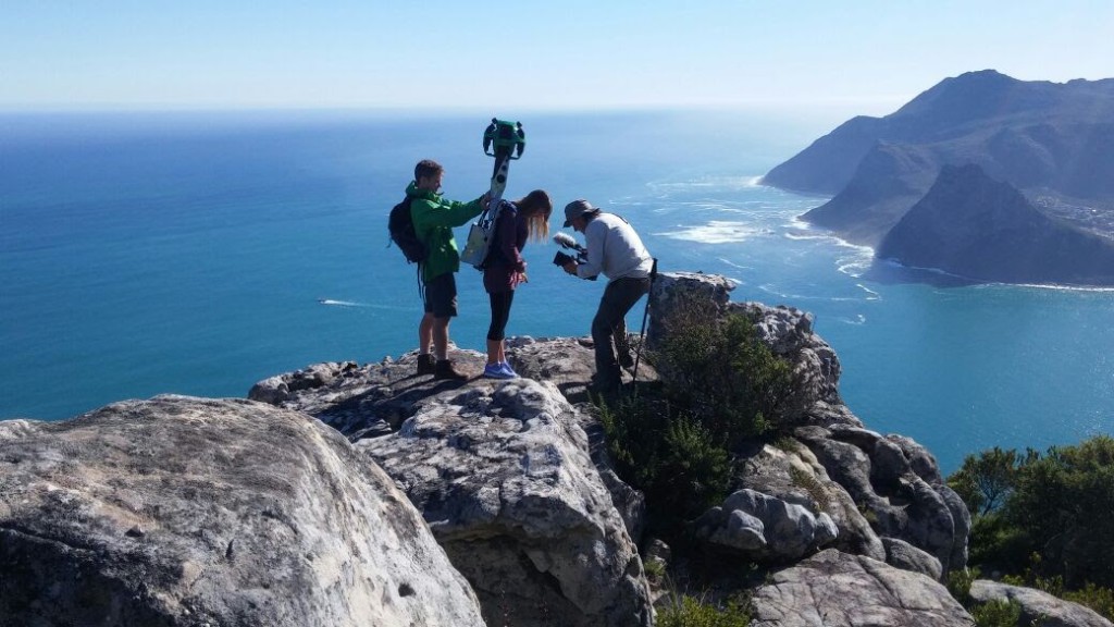
The chosen locations will be captured by Google’s Street View Trekker, a wearable backpack topped with a camera system. The contraption is carrier by volunteers through walkways and footpaths while it gathers imagery. The aim is to give Google Street View users a virtual tour of South Africa’s top attractions through 360-degree panoramic photographs.
The first phase of the project has seen 22 volunteer trekkers cover 33 trails across the Cape Peninsula, including seven routes up Table Mountain, five beaches and three urban trails such as the Sea Point promenade.
How it works: Becoming a Google Trekker entails carrying a high-tech 360-degree camera (either a backpack or an app-enabled 360 camera) which is given to participants via Google’s Street View camera loan programme. The participant then walks with the camera equipment through pre-determined areas, providing the Google team with thousands of images of the surroundings during the trek.
The programme is open to professional photographers, travellers and organisations such as tourism boards, non-profits, government agencies, universities and research groups. If you’re an individual who’d just like to promote the natural beauty of your area, you can also apply.
How to apply: Simply complete the online application form and wait for Google to contact you. Hopefully, you’ll soon get trekking.
For more info on Google Trekker in South Africa and how you can get involved, visit http://googletrekkingwith.drivesouthafrica.com/ or use #TrekSouthAfrica.


